Project: Ground penetrating radar survey
Customer: Place Partnership
Sector: Leisure management / Local government
Location: Worcester
The Challenge
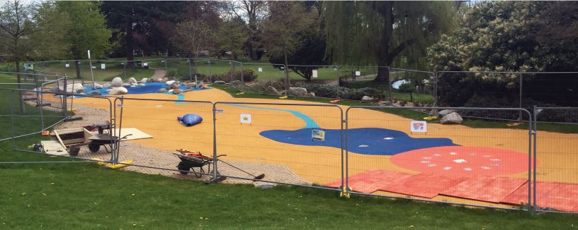
Splashpad had to close because one of its water tanks was found to have ruptured. With summer on the way, local councillors were keen to ensure the attraction was repaired and back in action as soon as possible.
However, there were no accurate site plans. To devise and manage a safe and effective repair, Place Partnership needed to establish the location and extent of the underground tanks and associated structures. Only then could they instruct a contractor on the best solution for a repair.
The Solution
- UKDN Waterflow (LG) Ltd was commissioned to carry out a ground penetrating radar (GPR) survey of the area
- This would generate radar images of underground structures
- It would avoid the need for trial excavations that would be more expensive and time-consuming, and might damage underground assets
- The images would allow hidden and unknown structures to be accurately plotted on site plans for the first time
- Place Partnership could then draw up the best and most cost-effective repair plans with confidence.
“The ground penetrating radar survey was a useful part of a solution that we needed to devise with urgency to get the Splashpad back open again in time for spring and summer, when it is most popular. Without it, we would have had to dig a number of trial holes, which risked damaging underground structures, would have taken more time, and would have probably increased costs.”
Andy Wood, Water Consultant, Place Partnership
The Customer
Place Partnership provides property and facilities management services for Worcester City Council. It is responsible for the maintenance of Splashpad, a popular attraction in Gheluvelt Park. Splashpad allows children to play with water pumped from one of two holding tanks buried in the ground nearby.
The Implementation
GPR – how it works
Ground penetrating radar (GPR) is also known as ground probing radar and georadar. An antennae on a wheeled device sends a very weak electromagnetic energy pulse into the ground.
The signal reacts differently to different underground structures. So when it is reflected back, and recorded by the GPR receiver, a 3-dimensional image of those structures is generated.
With some ground conditions, for example where there are heavy clays. GPR may penetrate only a matter of inches. With other materials, such as sandy soil or snow and ice, it can generate images up to 30ft or more beneath the surface, depending on the strength of the energy pulse generated.
Splashpad project
The UKDN Waterflow (LG) ground penetrating radar team took less than a day to carry out their survey. The images created clearly showed the extent of the tanks. They also showed the location of water supply pipes and electrical cables that ran to the Splashpad attraction from a nearby compound.
The images and a site plan, with the underground structures plotted on it, were included in the detailed GPR survey report.
The Results
- Place Partnership could draw up repair plans with confidence and in a timely manner
- The repair, involving pouring concrete around the outside of the tank, could be carried out without disrupting other underground assets
- Place Partnership now has an accurate ground survey to inform decision-making for on-going planned maintenance.


